https://play.google.com/store/apps/details?id=com.droidactor.seoulmetro
In short. Reading a Seoul station sign is hard when the Korean name is large and the romanized one is small. Dotori Seoul Metro is an Android subway map for visitors to Seoul and the area around it. The map stays sharp at any zoom level. You search for stations in your own language and compare each name with the Korean on the signs. The map and station search use data stored in the app, so they work without a local SIM or roaming.
A map that stays sharp when you zoom
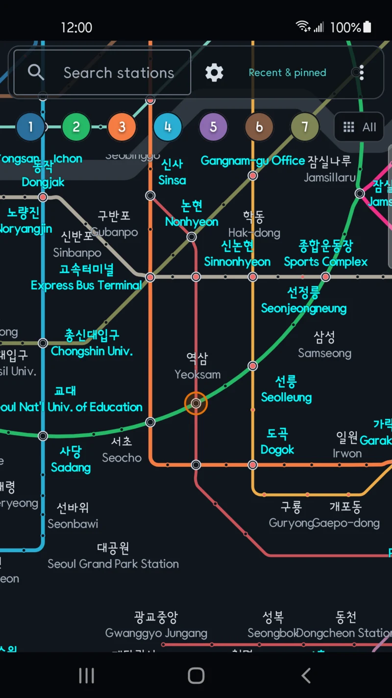
The map is drawn as vectors, not as an image. Pinch or double-tap to zoom and the station names redraw at that size. Drag to move, or use a mouse wheel when one is connected.
Tap the line buttons at the top to choose one or more lines. The chosen lines stay bold and the others fade. Keep only Line 2 and the Shinbundang Line, and your route is easier to follow.
Search the way you write
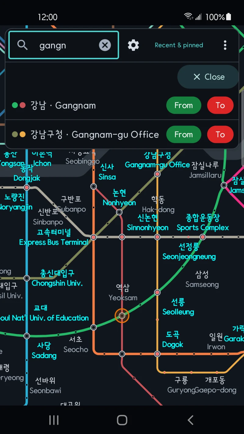
Type the name the way you know it. Gangnam Station, for example, comes up for any of these:
| You type | Who it suits |
|---|---|
gangnam | English and romanized names |
カンナム | Japanese |
江南 | Chinese |
강남 or the initials ㄱㄴ | Korean |
Romanized search tolerates some spelling variants and small typos. Each result has From and To buttons. Tap the station name to move the map there.
Station details and a Korean card to show staff
Tap a station on the map and a bar opens at the bottom with its name in Korean, English and your chosen language. It also lists the lines that stop there. Timetable shows departures from that station by direction for weekdays, Saturdays, and Sundays and holidays, with the first and last trains at the top. When a station has no translated name, the app shows the English one.
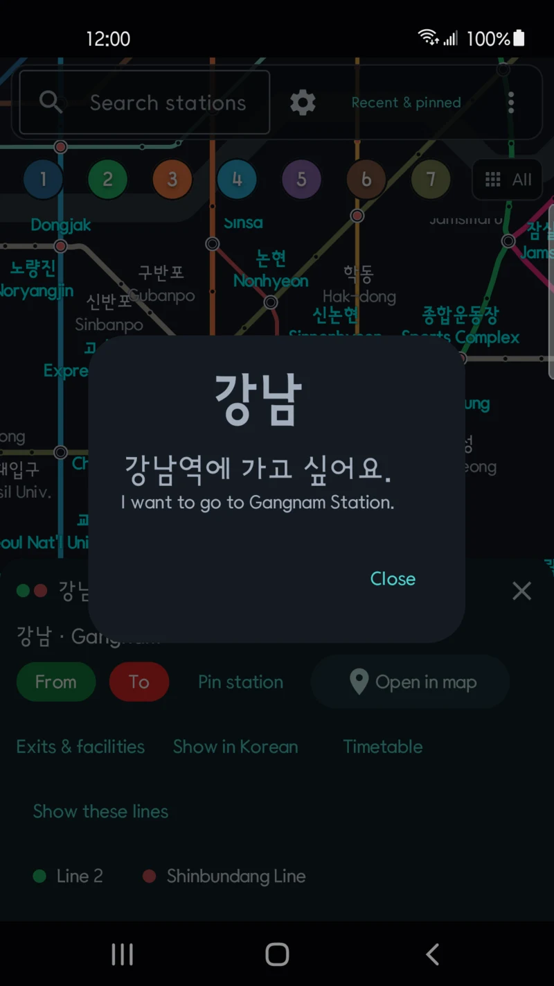
Show in Korean opens a card with the station's Korean name in large type. Below it is "강남역에 가고 싶어요". The English line reads "I want to go to Gangnam Station." Hold up the screen for station staff or someone nearby when words do not work.
The app screens come in 12 languages, including English, Korean, Japanese and Simplified and Traditional Chinese. In Settings you pick the screen language. You also choose which names the map shows: Korean, English, your language, or any mix. Screen languages and station-name translations cover different ranges.
Compare estimated routes
Choose From and To, and the app draws a route that weighs time and distance. One alternative appears when it scores at least 90% of the best candidate. Sections with unconfirmed distance data are left out. Transfers without walking-time data count as 10 extra minutes when routes are compared. Coverage details in the results lists them with the reasons.
The time shown is a local-train estimate. It leaves out the wait for your first train, transfer waits and express services. Where official timetable data exists, the app also shows the next train and the last departure on that route. It does not show live arrivals or service alerts. Follow the signs and operator announcements while you travel.
No account, and location is optional
You do not sign in or register. Location permission is optional. Allow it and the map moves to your nearest station. Without it, the map starts at Gangnam. Coordinates are not saved or sent to a developer server. A small banner ad sits at the top of the screen.
The map is based on the Seoul Metro subway map from Seoul Open Data Plaza (OA-22535). Dotori Seoul Metro is an independent app, not an official transport-operator app.
Install it before your trip
Install the app before you fly. Look up the station near where you will stay. A few minutes with the map at home makes the first ride from the airport feel less strange.
Get Dotori Seoul Metro on Google Play
Zoom from the whole network to every station name, highlight Lines 2 and 4, and find a route from Gangnam. Watch the app demo
Dotori Seoul Metro lets you find a station and compare its name with the Korean on the signs. More about Dotori Seoul Metro